United States · real traveler photos

Spots in San Francisco, photographed by the people who stood there.

Every pin in San Francisco is a real photo, pinned where a traveler actually stood, clustered around Haight-Ashbury, Castro District and Inner Sunset — not a business listing, not a scraped review. 446 spots so far, and the kind of corners, viewpoints, and streets people photograph but guidebooks miss.

446real spots, mapped where taken
7areas to explore
17travelers mapping it

Every dot is a real photo someone took in San Francisco, pinned where it was taken. Get the app to open the live, tappable map.

Map tiles © OpenStreetMap contributors · OpenFreeMap · OpenMapTiles

San Francisco on Photerra — the quick numbers: 446 real photo-spots, mapped where they were taken · mapped by 17 travelers · most-photographed area: Haight-Ashbury (110 photos) · newest spot added August 2026.

Haight-Ashbury

110 photo spots
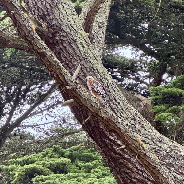
A red-tailed hawk perches on a massive oak tree branch in a forested area near the San Francisco Bay Area. — Haight-Ashbury, San Francisco
A red-tailed hawk perches on a massive oak tree branch in a forested area near the San Francisco Bay Area.Buena Vista
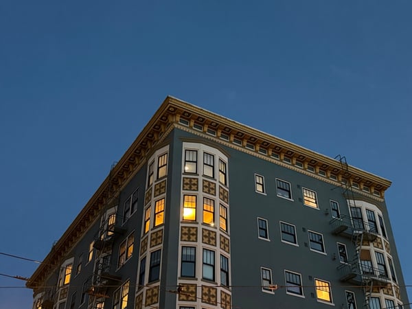
Historic Flatiron-style building with ornate cornice and illuminated windows at dusk in San Francisco. — Haight-Ashbury, San Francisco
Historic Flatiron-style building with ornate cornice and illuminated windows at dusk in San Francisco.Stanyan St & Hayes St
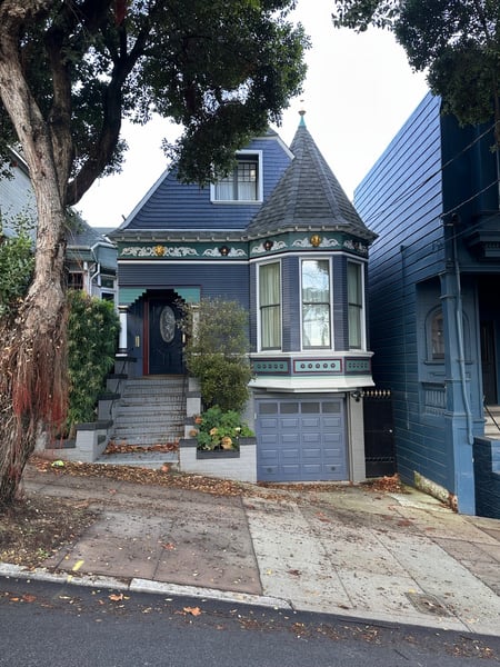
Victorian-style house with distinctive turret and blue siding on a San Francisco street, photographed from the sidewalk. — Haight-Ashbury, San Francisco
Victorian-style house with distinctive turret and blue siding on a San Francisco street, photographed from the sidewalk.
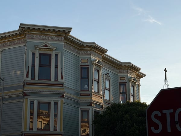
Victorian-style house with ornate cornice and bay windows, viewed from street level in San Francisco. — Haight-Ashbury, San Francisco
Victorian-style house with ornate cornice and bay windows, viewed from street level in San Francisco.
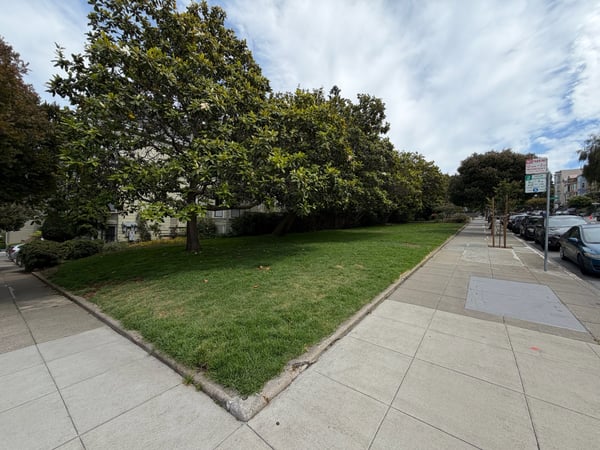
A tree-lined urban park with manicured lawn and sidewalk in a San Francisco residential neighborhood. — Haight-Ashbury, San Francisco
A tree-lined urban park with manicured lawn and sidewalk in a San Francisco residential neighborhood.Duboce Triangle
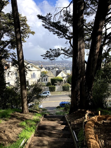
Victorian homes and distant cityscape viewed through tall cypress trees from Buena Vista Terrace, San Francisco. — Haight-Ashbury, San Francisco
Victorian homes and distant cityscape viewed through tall cypress trees from Buena Vista Terrace, San Francisco.
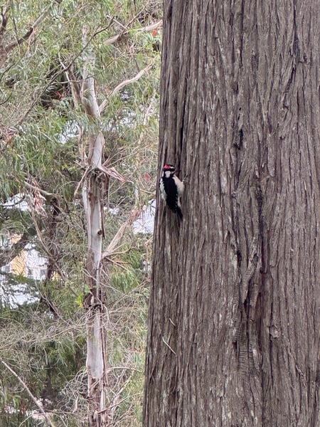
A pileated woodpecker forages on the bark of a large dead tree trunk in an urban natural area. — Haight-Ashbury, San Francisco
A pileated woodpecker forages on the bark of a large dead tree trunk in an urban natural area.Waller St
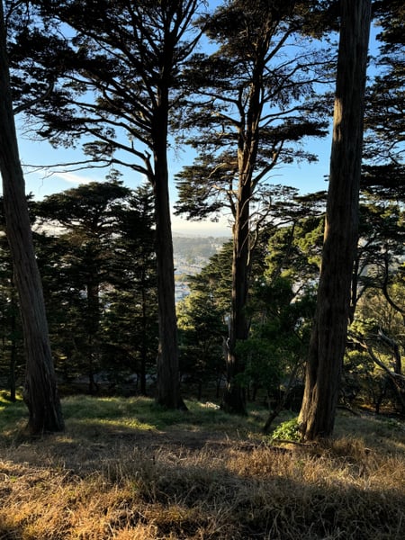
Tall cypress trees frame a distant city view across the bay from a forested hilltop in San Francisco. — Haight-Ashbury, San Francisco
Tall cypress trees frame a distant city view across the bay from a forested hilltop in San Francisco.Buena Vista Avenue West

What travelers shoot here: city · viewpoints · urban exploration · scenic views.

Underrated outdoor space just off of Haight-Ashbury. Enjoy a serene walk through a park with towering trees and open green spaces, perfect for relaxation and reflection.

— David

Go visit Zaid and get a bag of coffee good morning:)

— a Photerra traveler

Photo descriptions are written by a model from the photograph itself; the place names and coordinates are not.

See all 110 Haight-Ashbury photo spots →

Castro District

48 photo spots
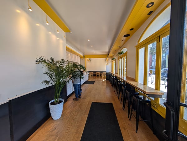
Modern café interior with yellow-framed windows, wooden counter seating, and contemporary design on 18th Street, San… — Castro District, San Francisco
Modern café interior with yellow-framed windows, wooden counter seating, and contemporary design on 18th Street, San…Mission Dolores
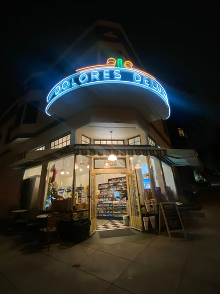
Dolores Deli storefront with iconic blue neon sign photographed at night in San Francisco. — Castro District, San Francisco
Dolores Deli storefront with iconic blue neon sign photographed at night in San Francisco.Dolores Heights
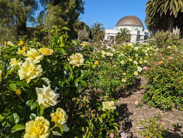
Rose garden with yellow blooms at Mission Dolores Park, with the Dolores Mission basilica dome visible in the… — Castro District, San Francisco
Rose garden with yellow blooms at Mission Dolores Park, with the Dolores Mission basilica dome visible in the…
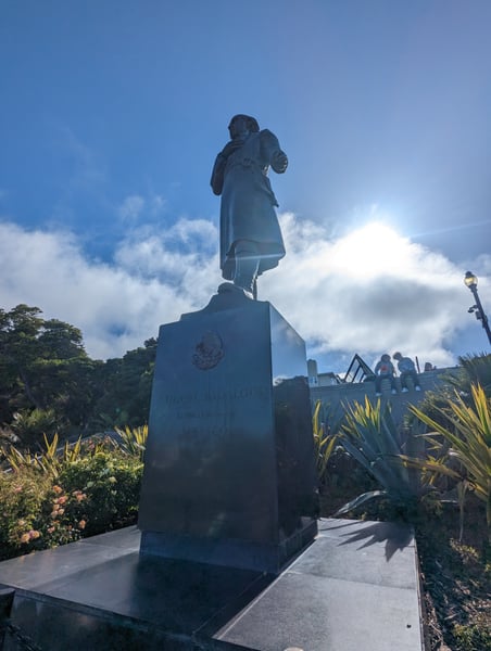
Bronze statue of Miguel Hidalgo on a stone pedestal in San Francisco, photographed from ground level against a blue sky. — Castro District, San Francisco
Bronze statue of Miguel Hidalgo on a stone pedestal in San Francisco, photographed from ground level against a blue sky.

What travelers shoot here: city · landmarks · urban exploration · food & dining — most photographed in May.

The Light House. Cool apartment building on the boarder of Dolores Park. You can't go inside but you wont miss it when visiting Dolores Park

— Bryce

They’ve got some great Sammies and a podcast. Talk to the owner- he’s a friendly guy.

— Pau

Photo descriptions are written by a model from the photograph itself; the place names and coordinates are not.

See all 48 Castro District photo spots →

Inner Sunset

67 photo spots
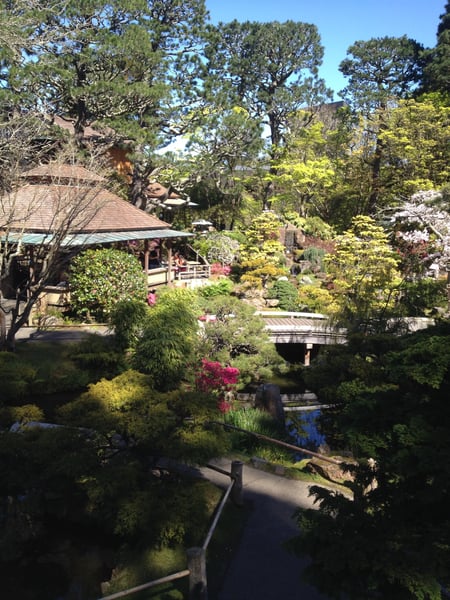
Japanese garden with traditional structures, wooden bridges, and flowering azaleas overlooking a pond, viewed from an… — Inner Sunset, San Francisco
Japanese garden with traditional structures, wooden bridges, and flowering azaleas overlooking a pond, viewed from an…Golden Gate Park
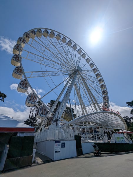
A large Ferris wheel with cream-colored gondolas photographed from ground level against a blue sky with light clouds. — Inner Sunset, San Francisco
A large Ferris wheel with cream-colored gondolas photographed from ground level against a blue sky with light clouds.Inner Richmond
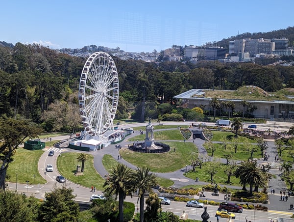
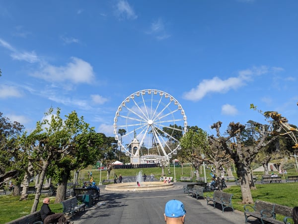
The Hamon Observation Tower Ferris wheel in Golden Gate Park with city skyline beyond. — Inner Sunset, San Francisco
The Hamon Observation Tower Ferris wheel in Golden Gate Park with city skyline beyond.
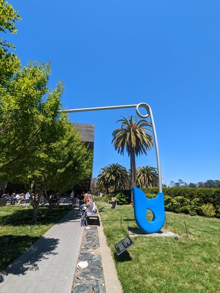
Giant Safety Pin sculpture in a San Francisco park with palm trees and manicured gardens under clear blue sky. — Inner Sunset, San Francisco
Giant Safety Pin sculpture in a San Francisco park with palm trees and manicured gardens under clear blue sky.
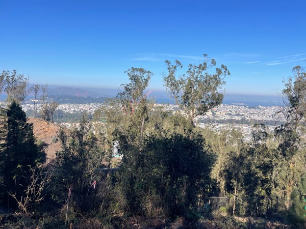
San Francisco cityscape and Bay Area viewed from a hilltop vantage point in Parnassus Heights on a clear day. — Inner Sunset, San Francisco
San Francisco cityscape and Bay Area viewed from a hilltop vantage point in Parnassus Heights on a clear day.
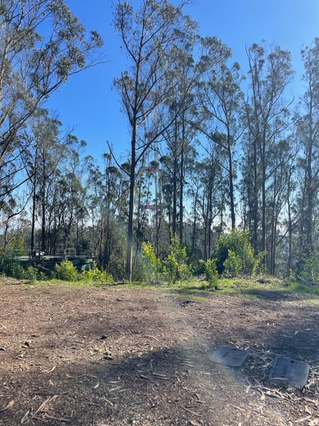
Tall eucalyptus forest with cleared ground and ranch fencing visible in the distance at Rotary Meadow. — Inner Sunset, San Francisco
Tall eucalyptus forest with cleared ground and ranch fencing visible in the distance at Rotary Meadow.
A white Ferris wheel rises above Rideout Fountain in a public park, framed by mature trees and green lawns on a clear… — Inner Sunset, San Francisco
A white Ferris wheel rises above Rideout Fountain in a public park, framed by mature trees and green lawns on a clear…

What travelers shoot here: parks · landmarks · landscapes · nature & wildlife — most photographed in March.

Known as Three Gems, or the Turrell Skyspace, find the hidden entrance to this small tunnel with an art exhibit on the other side.

— Bryce

There are some easy and free exhibits outside of the museum. Inside, check out the observation deck that is open to the public!

— Bryce

Photo descriptions are written by a model from the photograph itself; the place names and coordinates are not.

Midtown Terrace

24 photo spots
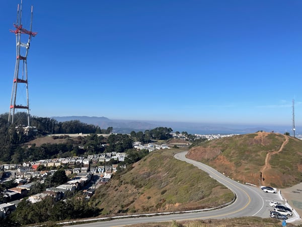
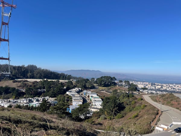
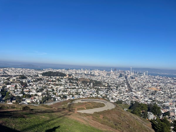
Twin Peaks overlook with winding road, communication tower, and San Francisco Bay vista in the distance. — Midtown Terrace, San Francisco
Twin Peaks overlook with winding road, communication tower, and San Francisco Bay vista in the distance.Noe Peak
Expansive view of San Francisco from Twin Peaks, showing residential neighborhoods, bay waters, and distant mountains… — Midtown Terrace, San Francisco
Expansive view of San Francisco from Twin Peaks, showing residential neighborhoods, bay waters, and distant mountains…Eureka Peak
San Francisco cityscape and bay viewed from Twin Peaks, with a circular sports facility visible in the foreground. — Midtown Terrace, San Francisco
San Francisco cityscape and bay viewed from Twin Peaks, with a circular sports facility visible in the foreground.Christmas Tree Point

What travelers shoot here: viewpoints · city · scenic views · landmarks — most photographed in November.

Photo descriptions are written by a model from the photograph itself; the place names and coordinates are not.

Muir Beach

19 photo spots
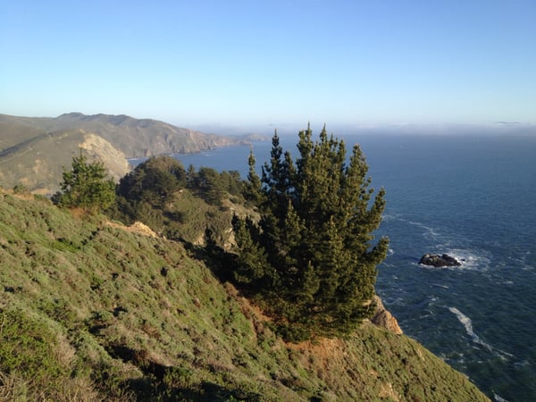
Coastal cliffs with coniferous trees overlooking the Pacific Ocean, viewed from a hillside trail near Muir Beach… — Muir Beach, San Francisco
Coastal cliffs with coniferous trees overlooking the Pacific Ocean, viewed from a hillside trail near Muir Beach…
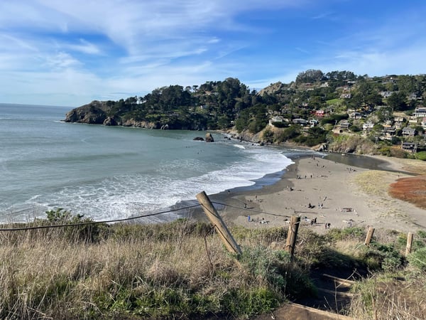
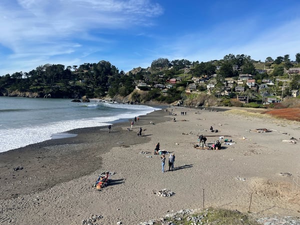
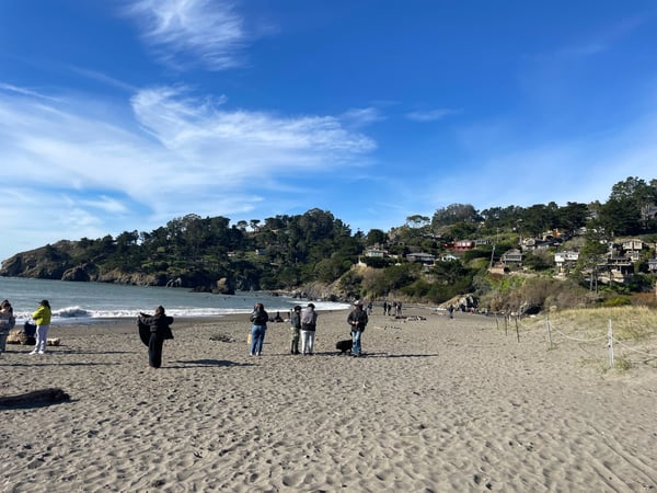
Sandy beach with visitors and breaking waves, backed by forested hillside with residential homes at Muir Beach… — Muir Beach, San Francisco
Sandy beach with visitors and breaking waves, backed by forested hillside with residential homes at Muir Beach…
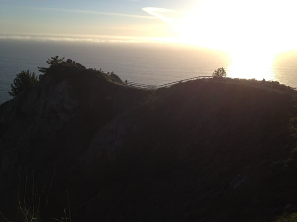
Sunset view from Muir Beach Overlook with a footbridge connecting rocky outcrops overlooking the Pacific Ocean. — Muir Beach, San Francisco
Sunset view from Muir Beach Overlook with a footbridge connecting rocky outcrops overlooking the Pacific Ocean.
Sandy beach cove with gentle waves and hillside homes viewed from coastal bluff at Muir Beach, California. — Muir Beach, San Francisco
Sandy beach cove with gentle waves and hillside homes viewed from coastal bluff at Muir Beach, California.
Muir Beach cove with dark sand, gentle waves, and hillside homes viewed from the beach. — Muir Beach, San Francisco
Muir Beach cove with dark sand, gentle waves, and hillside homes viewed from the beach.

What travelers shoot here: scenic views · viewpoints · landscapes · beaches — most photographed in March.

Photo descriptions are written by a model from the photograph itself; the place names and coordinates are not.

Financial District

21 photo spots
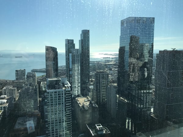
San Francisco downtown skyline with high-rise buildings and bay views from an elevated vantage point. — Financial District, San Francisco
San Francisco downtown skyline with high-rise buildings and bay views from an elevated vantage point.SoMa
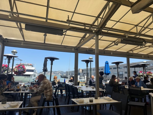
Waterfront dining at a covered outdoor café with marina views and sailboats visible in the background. — Financial District, San Francisco
Waterfront dining at a covered outdoor café with marina views and sailboats visible in the background.The Embarcadero
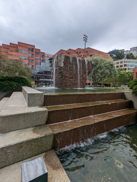
Modern sculptural fountain with water cascading down a textured stone monolith in an urban plaza surrounded by… — Financial District, San Francisco
Modern sculptural fountain with water cascading down a textured stone monolith in an urban plaza surrounded by…Northern Waterfront
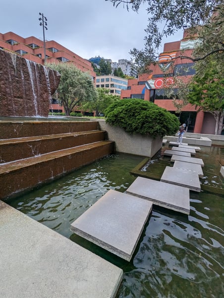
Modern brick buildings with a contemporary water feature and stepping stones in an urban plaza setting. — Financial District, San Francisco
Modern brick buildings with a contemporary water feature and stepping stones in an urban plaza setting.Levi's Plaza Fountain
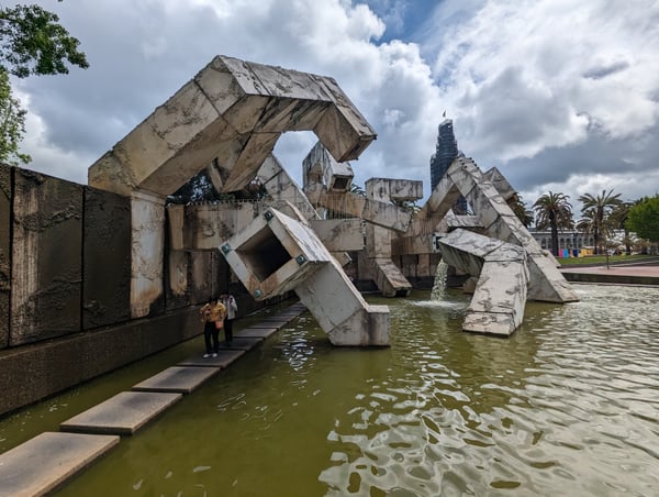
Vaillancourt Fountain's brutalist concrete sculpture and cascading water feature viewed from ground level in San… — Financial District, San Francisco
Vaillancourt Fountain's brutalist concrete sculpture and cascading water feature viewed from ground level in San…
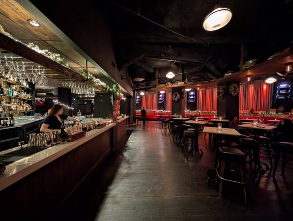
Interior of an upscale bar with red-draped windows, full bar counter, and festive holiday decorations during evening… — Financial District, San Francisco
Interior of an upscale bar with red-draped windows, full bar counter, and festive holiday decorations during evening…Yerba Buena
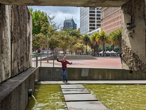
Person enjoying a modern urban plaza framed through a concrete underpass, with downtown buildings and palm trees… — Financial District, San Francisco
Person enjoying a modern urban plaza framed through a concrete underpass, with downtown buildings and palm trees…

What travelers shoot here: architecture · city · viewpoints · nightlife & bars — most photographed in December.

Enjoy the newspaper decor in the basement haunt. We got there pretty early so the place was nearly empty, but it does fill up especially if they have live music that evening.

— Bryce

Amazing Peruvian restaurant near the Ferry Building

— Ceci

Photo descriptions are written by a model from the photograph itself; the place names and coordinates are not.

Across San Francisco

184 photo spots
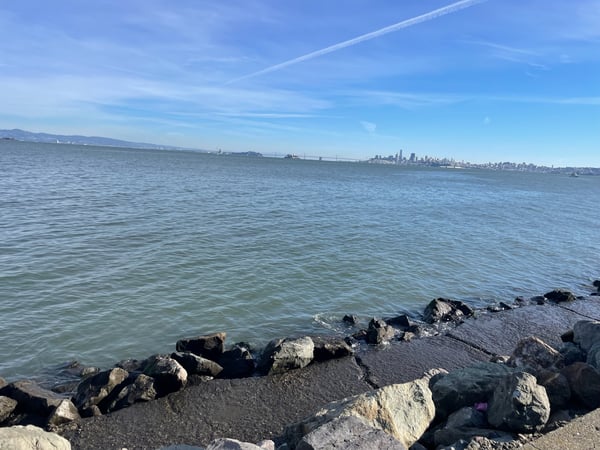
San Francisco skyline and Golden Gate Bridge viewed across the bay from a rocky beach in Sausalito, California.
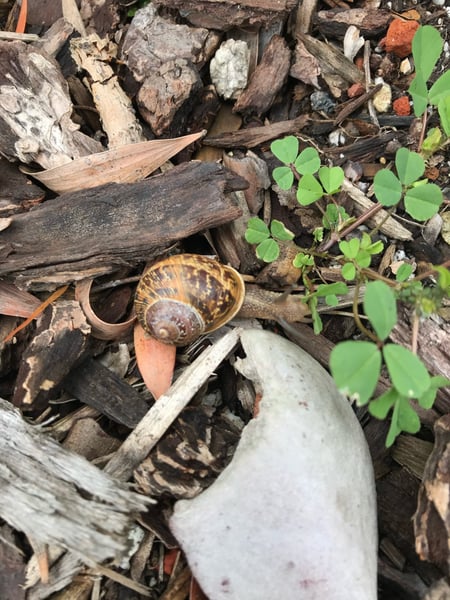
A snail and sprouting clover among decaying wood and rocks on forest ground. — San Francisco
A snail and sprouting clover among decaying wood and rocks on forest ground.Civic Center
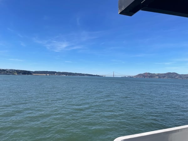
Golden Gate Bridge viewed from a ferry or boat in San Francisco Bay with Marin Headlands visible across the water.
Golden Gate Bridge viewed from a ferry or boat in San Francisco Bay with Marin Headlands visible across the water.Fisherman's Wharf
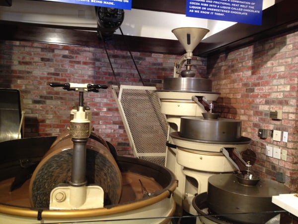
Historical chocolate-making machinery and equipment displayed in a museum exhibit with exposed brick walls. — San Francisco
Historical chocolate-making machinery and equipment displayed in a museum exhibit with exposed brick walls.Fort Mason
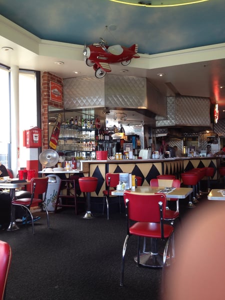
Retro 1950s diner interior with red vinyl seating, aircraft ceiling decoration, and geometric bar pattern at… — San Francisco
Retro 1950s diner interior with red vinyl seating, aircraft ceiling decoration, and geometric bar pattern at…Ghirardelli Square
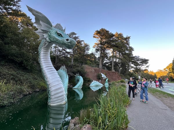
A large turquoise dragon sculpture in a park pond with visitors on a walking path nearby during autumn. — San Francisco
A large turquoise dragon sculpture in a park pond with visitors on a walking path nearby during autumn.Rainbow Falls
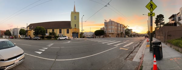
Urban intersection at sunset with a yellow church, apartment buildings, and street infrastructure in San Francisco.
Urban intersection at sunset with a yellow church, apartment buildings, and street infrastructure in San Francisco.Turk St & Lyon St
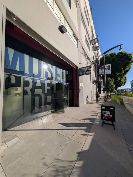
Museum of Craft and Design storefront on a pedestrian street in San Francisco's Mission Bay district.

What travelers shoot here: landmarks · scenic views · viewpoints · urban exploration — most photographed in March.

Come in for a chicken sandwich you wont regret. Have a brew while you're there, and if you're going to stay a while head to the back where there's more open seating

— Bryce

Hila gelato caffè. Sicilian gelato, coffee, desserts. Women LGBT owned. Music events. Gelato Making Classes.

— Ceci

Photo descriptions are written by a model from the photograph itself; the place names and coordinates are not.

On the map

Landmarks on the map in San Francisco.

From the landmarks everyone knows to the corners nobody thought to list — real places the community has pinned, each with the photograph the traveler actually took, and growing as more share them.

Golden Gate Park 35 spots37.7700, -122.4701 Mission 33 spots37.7587, -122.4205 Western Addition 20 spots37.7706, -122.4317 Civic Center 13 spots37.7772, -122.4189 Inner Richmond 13 spots37.7725, -122.4593 Eureka Peak 11 spots37.7534, -122.4474 Potrero Hill 10 spots37.7591, -122.4113 Richmond District 9 spots37.7703, -122.4810 Alcatraz Island 9 spots37.8268, -122.4229 Noe Peak 9 spots37.7517, -122.4477 Marina District 8 spots37.8095, -122.4267 Muir Beach Overlook 7 spots37.8629, -122.5857 North Beach 6 spots37.8027, -122.4059 Fort Mason 6 spots37.8104, -122.4259 Alcatraz Main Cell House 6 spots37.8268, -122.4229 Meadowsweet 5 spots37.9335, -122.5177

Coordinates are where a traveler stood to take the photograph — the medoid of this place’s pins, at 4 decimals (~11 m). Not an official gazetteer position.

Plus 404+ more spots across San Francisco — see every pin on the live map in the app, or browse all destinations.

Good to know

San Francisco spots, the quick version.

How many spots does Photerra have in San Francisco?

446 and counting — each one a real photo pinned where it was taken. New spots appear as travelers share them.

Are these San Francisco spots on Google Maps?

Many aren't. Photerra's spots are photo-coordinates — viewpoints, benches, trailheads and corners with no business listing or address — so they don't show up on maps built from business directories.

How do I get to a spot with no address?

Open any spot in the Photerra app and tap once to launch Apple Maps, Google Maps, Uber or Lyft — we hand them the coordinates even when the place has no name.
Get the San Francisco map in your pocket.

Free on iOS and Android. Browse every spot, filter by time of day — including golden hour — and let the AI build a day-by-day trip around the ones you like.

Live in San Francisco? Your camera roll is already a map — become one of its founding mappers.