San Francisco · United States · real photographs

Photo spots in Inner Sunset, San Francisco.

Every pin in Inner Sunset is a real photograph, pinned about where it was taken — not a business listing, not a scraped review. 81 spots in this San Francisco neighbourhood: the corners, viewpoints and streets people photograph but guidebooks miss.

81real spots, mapped where taken
7photos on this page
17travelers mapping San Francisco

Every dot is a real photo someone took in Inner Sunset, pinned where it was taken. Get the app to open the live, tappable map.

Map tiles © OpenStreetMap contributors · OpenFreeMap · OpenMapTiles

Photo spots in Inner Sunset

81 photo spots
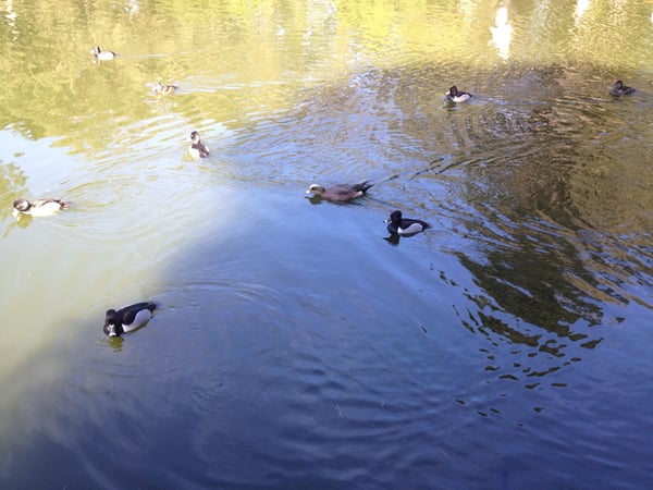
Ducks and waterfowl swimming in Lloyd Lake in San Francisco's Golden Gate Park. — Inner Sunset, San Francisco
Ducks and waterfowl swimming in Lloyd Lake in San Francisco's Golden Gate Park.
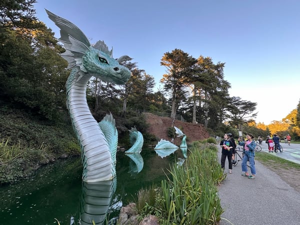
A large turquoise dragon sculpture in a park pond with visitors on a walking path nearby during autumn. — Inner Sunset, San Francisco
A large turquoise dragon sculpture in a park pond with visitors on a walking path nearby during autumn.Rainbow Falls
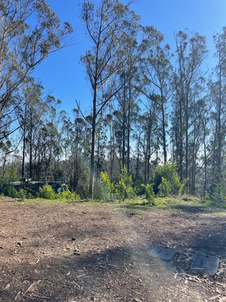
Tall eucalyptus forest with cleared ground and ranch fencing visible in the distance at Rotary Meadow. — Inner Sunset, San Francisco
Tall eucalyptus forest with cleared ground and ranch fencing visible in the distance at Rotary Meadow.
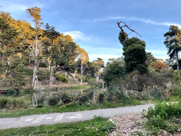
A winding path alongside a calm water body with tall trees and ivy-covered specimens at Stow Lake. — Inner Sunset, San Francisco
A winding path alongside a calm water body with tall trees and ivy-covered specimens at Stow Lake.Stow Lake Bridge
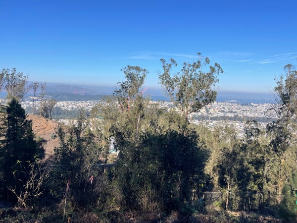
San Francisco cityscape and Bay Area viewed from a hilltop vantage point in Parnassus Heights on a clear day. — Inner Sunset, San Francisco
San Francisco cityscape and Bay Area viewed from a hilltop vantage point in Parnassus Heights on a clear day.
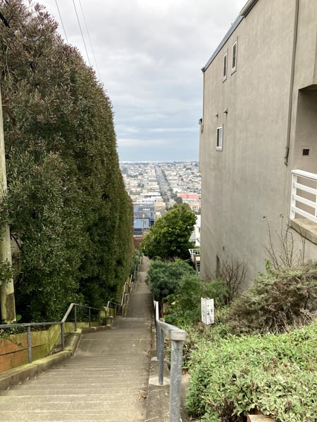
Narrow residential alleyway with city vista visible through the passage toward the bay, taken from a hillside… — Inner Sunset, San Francisco
Narrow residential alleyway with city vista visible through the passage toward the bay, taken from a hillside…Golden Gate Heights
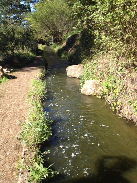
A flowing creek runs alongside a dirt trail lined with lush vegetation and overhanging trees in a wooded area. — Inner Sunset, San Francisco
A flowing creek runs alongside a dirt trail lined with lush vegetation and overhanging trees in a wooded area.Golden Gate Park

Photo descriptions are written by a model from the photograph itself; the place names and coordinates are not.

What travelers shoot here: parks · lakes & rivers · scenic views · landscapes — most photographed in November.

Some easy to get to viewpoints in various parks, and one of sf’s classic hidden staircases

— David
On the map

Landmarks on the map in Inner Sunset.

Real places pinned in Inner Sunset, each with the photograph someone actually took — contributed by travellers and by the openly-licensed archive, and growing as more are added.

Lloyd Lake 4 spots37.7703, -122.4810 Golden Gate Park 4 spots37.7687, -122.4774 Rainbow Falls 2 spots37.7714, -122.4781 Stow Lake Bridge 2 spots37.7683, -122.4776 Golden Gate Heights 2 spots37.7535, -122.4720 Rotary meadow 1 spot37.7581, -122.4572

Coordinates are about where the photograph was taken — the medoid of this place’s pins, at 4 decimals (~11 m). Approximate by design, and not an official gazetteer position.

See every Inner Sunset pin on the live map in the app, or explore all of San Francisco.

Good to know

Inner Sunset spots, the quick version.

How many photo spots are in Inner Sunset?

81 and counting — each a real photograph, pinned about where it was taken in Inner Sunset, San Francisco. The map grows as people add to it and as the open archive is reviewed in.

Are these Inner Sunset spots on Google Maps?

Many aren't. They're photo-coordinates — viewpoints, stairways and corners with no business listing — so they don't show up on maps built from business directories.

How do I get to a spot with no address?

Open any spot in the Photerra app and tap once to launch Apple Maps, Google Maps, Uber or Lyft — we hand them the coordinates even when the place has no name.

Get the Inner Sunset map in your pocket.

Free on iOS and Android. Browse every spot, filter by time of day — including golden hour — and let the AI build a day-by-day trip around the ones you like.