Japan · real traveler photos

Spots in Kyoto, photographed by the people who stood there.

Every pin in Kyoto is a real photo at the exact coordinate a traveler stood, clustered around Nishikyo Ward, Nakagyo Ward and Sakyō Ward — not a business listing, not a scraped review. 38 spots so far, and the kind of corners, viewpoints, and streets people photograph but guidebooks miss.

38real spots, exact coordinates
3areas to explore
3travelers mapping it

Every dot is a real photo someone took in Kyoto, pinned to the exact coordinate. Get the app to open the live, tappable map.

Map tiles © OpenStreetMap contributors · OpenFreeMap

Kyoto on Photerra — the quick numbers: 38 real photo-spots at exact coordinates · mapped by 3 travelers · most-photographed area: Nishikyo Ward (10 photos) · newest spot added June 2026.

Nakagyo Ward

9 photo spots
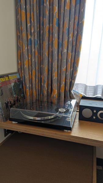
A turntable and audio equipment displayed on a wooden desk in a hotel room with patterned curtains overlooking a window. — Nakagyo Ward, Kyoto
A turntable and audio equipment displayed on a wooden desk in a hotel room with patterned curtains overlooking a window.Kurumayachō
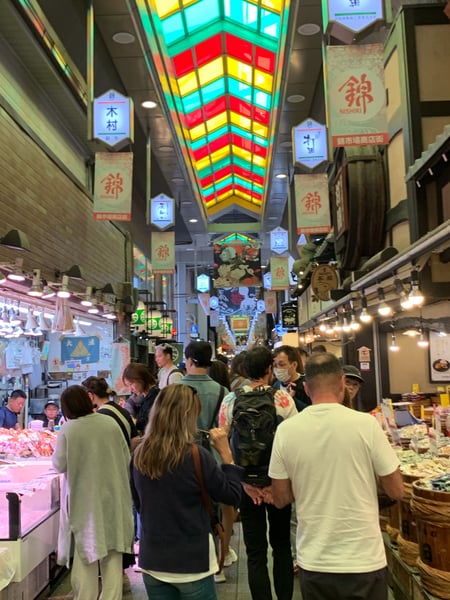
Crowded covered market corridor with colorful neon signage and vendor stalls in Kyoto, Japan. — Nakagyo Ward, Kyoto
Crowded covered market corridor with colorful neon signage and vendor stalls in Kyoto, Japan.
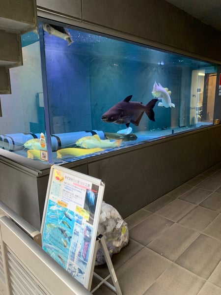
Aquarium display tank with dark-colored shark and yellow fish viewed from indoor facility in Kyoto, Japan. — Nakagyo Ward, Kyoto
Aquarium display tank with dark-colored shark and yellow fish viewed from indoor facility in Kyoto, Japan.
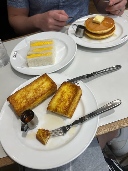
Traditional Japanese breakfast spread featuring French toast, tamagoyaki sandwich, and fluffy pancakes at a dining… — Nakagyo Ward, Kyoto
Traditional Japanese breakfast spread featuring French toast, tamagoyaki sandwich, and fluffy pancakes at a dining…Tenshōjimaechō

What travelers shoot here: food & dining · history & culture · cuisine · markets & shopping — most photographed in April.

Fun, beautiful, environmentally conscious hotel w/ interesting amenities. Check-in is at 3pm, but if you get there early they will hold your bags for you while you explore the city. They have bicycles (electric & regular) you can borrow by availability. Also vinyls in the lobby you can take to play on the player in your hotel room. Plenty of shops to explore in the connected courtyard, as well as a connection to the subway. Stumptown coffee roasters attached to the hotel as well.

— a Photerra traveler

Ukyō Ward

5 photo spots
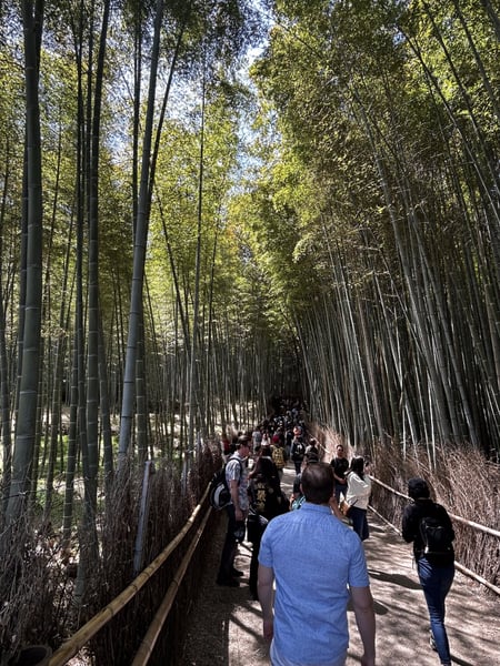
Visitors walking through the Arashiyama Bamboo Forest on a wooden pathway lined with tall bamboo stalks. — Ukyō Ward, Kyoto
Visitors walking through the Arashiyama Bamboo Forest on a wooden pathway lined with tall bamboo stalks.
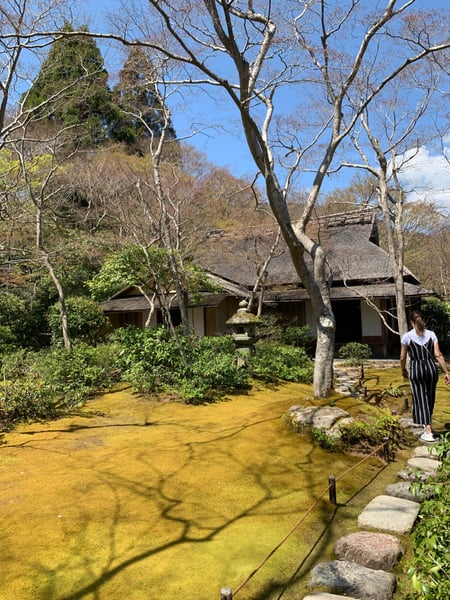
Traditional Japanese temple building with golden pond and bare trees viewed from a stone pathway in spring. — Ukyō Ward, Kyoto
Traditional Japanese temple building with golden pond and bare trees viewed from a stone pathway in spring.
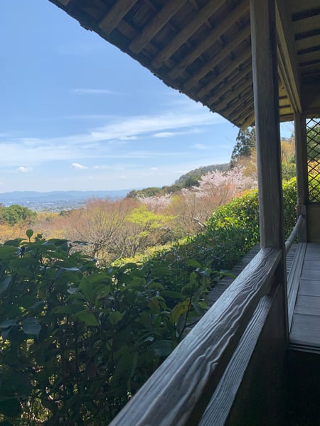
Hillside landscape with blooming cherry blossoms viewed from a traditional wooden pavilion overlooking a valley in… — Ukyō Ward, Kyoto
Hillside landscape with blooming cherry blossoms viewed from a traditional wooden pavilion overlooking a valley in…

What travelers shoot here: forests · parks · hiking & trails · landmarks — most photographed in April.

Across Kyoto

24 photo spots
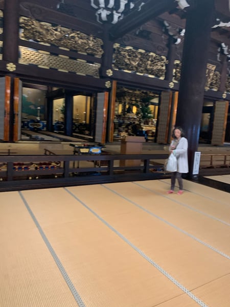
Interior courtyard of a traditional Japanese temple or shrine in Kyoto, with tatami mat flooring and ornate dark wooden…
Interior courtyard of a traditional Japanese temple or shrine in Kyoto, with tatami mat flooring and ornate dark wooden…Shimogyo Ward
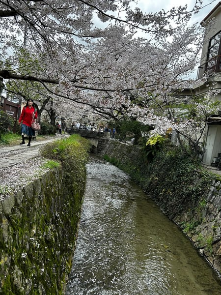
Cherry blossom-lined canal with stone bridge and visitors during spring bloom in Kyoto's Philosopher's Path area.
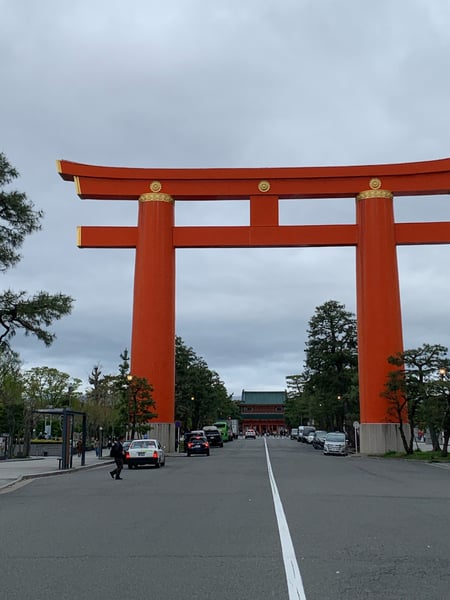
A large red torii gate at the entrance to a Shinto shrine in Kyoto, photographed from street level during daytime.
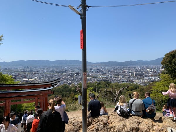
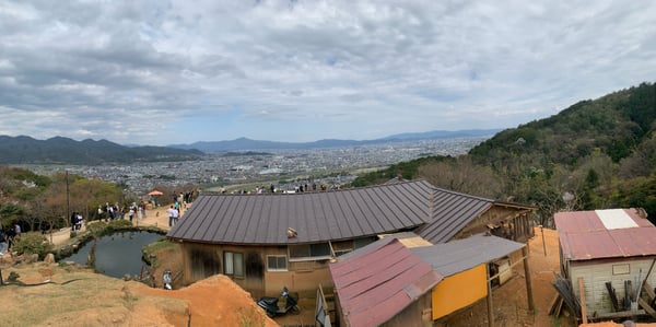
Kyoto cityscape viewed from an elevated shrine viewpoint overlooking the urban valley and surrounding mountains.
Kyoto cityscape viewed from an elevated shrine viewpoint overlooking the urban valley and surrounding mountains.Fushimi Ward
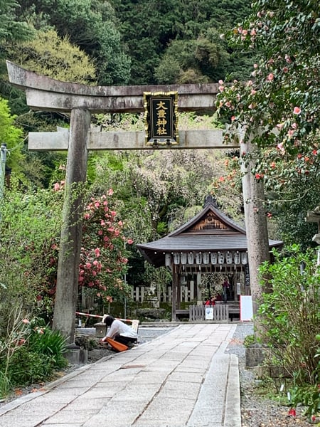
Japanese Shinto shrine with torii gate and wooden structure framed by blooming camellia flowers and lush forest… — Kyoto
Japanese Shinto shrine with torii gate and wooden structure framed by blooming camellia flowers and lush forest…Sakyo Ward
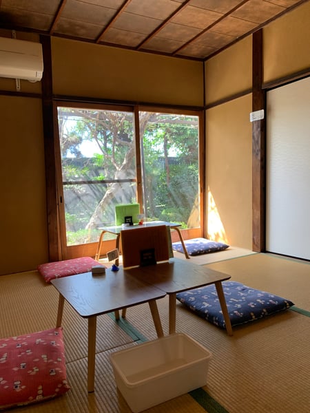
Traditional Japanese room with tatami flooring, low table, and garden view through large windows. — Kyoto
Traditional Japanese room with tatami flooring, low table, and garden view through large windows.
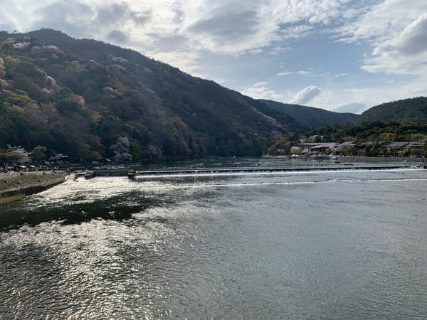
A river valley with forested mountains and riverside structures viewed from the bank during spring in Kyoto, Japan.
Expansive cityscape with meandering river viewed from elevated hillside overlook with forested foreground. — Kyoto
Expansive cityscape with meandering river viewed from elevated hillside overlook with forested foreground.Arashiyama Genrokuzanchō

What travelers shoot here: history & culture · landmarks · architecture · viewpoints — most photographed in April.

On the map

Spots travelers have mapped in Kyoto.

From the landmarks everyone knows to the corners nobody thought to list — real places the community has pinned, each with the photograph the traveler actually took, and growing as more share them.

Nishikyo Ward 10 spots Sakyō Ward 6 spots Shimogyo Ward 3 spots Arashiyama Bamboo Forest 3 spots Higashiyama Ward 2 spots Nishki Market 1 spot

Plus 23+ more spots across Kyoto — see every pin on the live map in the app, or browse all destinations.

Good to know

Kyoto spots, the quick version.

How many spots does Photerra have in Kyoto?

38 and counting — each one a real photo pinned to the exact coordinate it was taken. New spots appear as travelers share them.

Are these Kyoto spots on Google Maps?

Many aren't. Photerra's spots are photo-coordinates — viewpoints, benches, trailheads and corners with no business listing or address — so they don't show up on maps built from business directories.

How do I get to a spot with no address?

Open any spot in the Photerra app and tap once to launch Apple Maps, Google Maps, Uber or Lyft — we hand them the exact coordinates even when the place has no name.
Get the Kyoto map in your pocket.

Free on iOS and Android. Browse every spot, filter by time of day — including golden hour — and let the AI build a day-by-day trip around the ones you like.

Live in Kyoto? Your camera roll is already a map — become one of its founding mappers.